
Naser Asiabipourimani and Lawrence K. Tsuro
Severe ecological disturbances are increasingly defining today’s global theatre. Climate change, systemic water scarcity, biodiversity loss, and rapid desertification are no longer hypothetical dangers; they are real crises endangering the survival of sovereign nations.
Traditional environmental governance frameworks, which rely on infrequent manual sampling and historical data modelling, are essentially ineffective in dealing with the non-linear rate of modern ecological degradation. To negotiate this volatile matrix, the international community must shift its focus to the technology paradigm of the Fourth Industrial Revolution.
Artificial Intelligence (AI) is at the forefront of this revolution, providing a paradigm shift in how states monitor, analyse, and preserve their natural resources. As a result, while synthesising large, multispectral environmental datasets in real time, AI transforms passive ecological observation into predictive, actionable statecraft.
Examining Iran’s domestically produced AI systems for wetland hydro-informatics, dust-storm prediction, air-quality regulation, precision agriculture, and forest conservation as a best practice under technology constraints.
These verified techniques provide a transferable, sovereignty-enhancing framework with proven benefits for drought early warning, anti-poaching, transboundary water management, and South-South cooperation, particularly in Zimbabwe.
Transformative role of AI
Artificial intelligence serves as a force multiplier in all fundamental disciplines of environmental management, allowing human agencies to interpret complicated geographic and telemetry data with astonishing precision using machine learning, deep neural networks, and computer vision.
In water resource management, AI algorithms assess hydrological variables evaporation rates, precipitation anomalies, soil moisture, and consumer demand curves to optimise distribution across river basins, with smart grid systems automatically managing reservoir releases and minimising transmission losses to preserve reserves during prolonged droughts.
AI-powered systems also revolutionise atmospheric monitoring and climate mitigation: by combining internet of things (IoT) sensor networks with predictive machine learning, authorities can study urban and industrial pollutant dispersion in real time, trace particulate matter and greenhouse gas emissions to specific localised sources, and send out preemptive public health notifications.
Concurrently, in forestry and biodiversity conservation, deep learning systems process high-resolution satellite imagery and drone telemetry to automatically detect subtle deviations in canopy health, trace illegal logging in remote frontiers, and model wildfire propagation risks based on ambient heat indexes, wind velocity, and biomass accumulation, allowing for rapid interventions before ecological tipping points are reached.
Iran’s experiences, best practices
Despite decades of illegal, unilateral coercive measures severely restricting access to international software, hardware, and specialised sensory equipment, Iran has developed a sophisticated, self-sufficient technology ecosystem in which universities, government research organisations, and commercial technology enterprises have produced homegrown AI solutions for profound environmental concerns.
A key milestone is the comprehensive hydro-informatics system for the Lake Urmia basin: Iranian scientists developed custom neural networks processing multi-spectral satellite imagery and localised remote-sensing telemetry to model the basin’s hydrological inflows, enabling automated, precise calibration of upstream agricultural dam discharges to maintain ecological water rights while sustaining local agricultural yield.
Institutional developments highlight the effort’s scale. Iran’s national Lake Urmia restoration taskforce has formally integrated AI and current smart technologies into its core strategy, explicitly linking algorithmic water-resource management to reduced agricultural usage across 327 000 hectares of pilot sites.
Peer-reviewed work published in 2025 has further advanced modelling capacity, including daily water-level prediction using remote sensing and optimisation.
Predictive modelling of sand, dust storms
Beyond wetland conservation, Iran has made significant breakthroughs against sand and dust storms (SDSs) and hyper-arid desertification, which pose severe socio-economic risks across the Middle East: specialised Iranian research centres use deep-learning classification algorithms to parse historical meteorological patterns and temporal satellite arrays.
Meanwhile, major Iranian cities such as Tehran, Mashhad, and Isfahan rely on locally developed AI-powered atmospheric dispersion models that collect real-time data from urban IoT air-quality sensors and forecast thermal inversion layers and stagnant atmospheric conditions up to 72 hours in advance, allowing municipal authorities to dynamically regulate industrial outputs and high-traffic areas.
Precision agriculture, automated forest protection
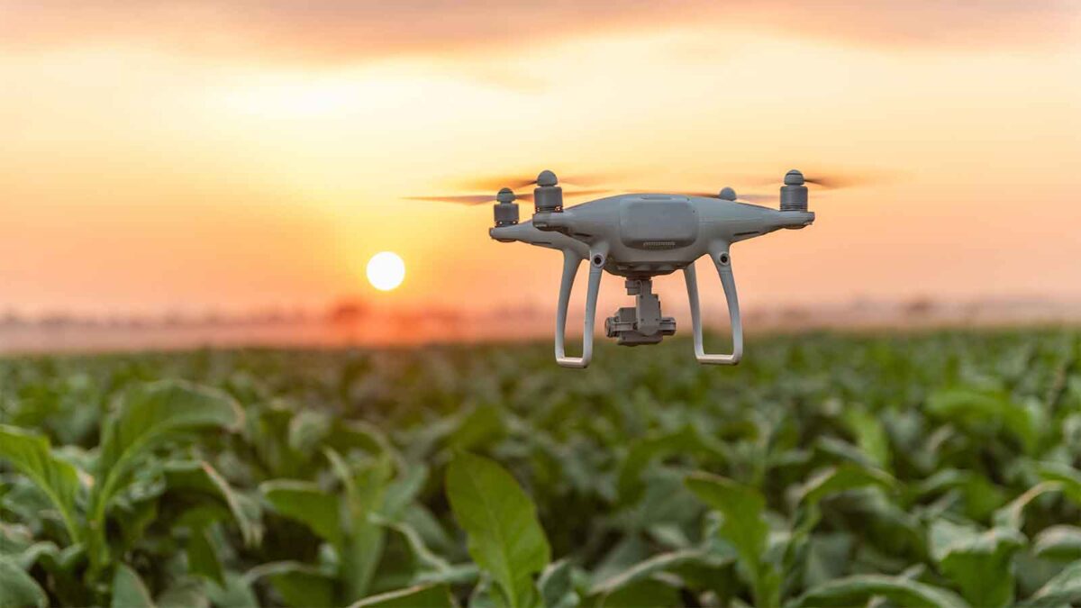
Iran has pioneered AI-integrated smart agriculture and precision forestry for long-term sustainability. In agriculture, localised machine-learning models process hyperspectral drone data to detect crop stress, soil salinity, and nutrient deficiencies before visible symptoms, enabling precise micro-irrigation and targeted fertilisation that reduce runoff into water tables.
In forestry, particularly the ecologically vulnerable Hyrcanian forests Iran has deployed automated auditory and visual monitoring networks: deep-learning auditory models scan ambient forest noise, filter out biophony, and rapidly isolate chainsaw or heavy-machinery frequencies to alert ranger stations in real time against illegal logging.
Enforcement agencies have publicly verified the operational deployment of smart monitoring systems, surveillance cameras, sound-detection sensors calibrated to chainsaw noise, and AI analytical platforms for early detection of forestry crimes.
Published machine-learning analyses of deforestation drivers provide a spatial-statistical foundation for more effective enforcement and restoration. Furthermore, Iranian energy networks have integrated artificial intelligence (AI) into national thermal power grids to monitor and reduce carbon footprints, maximising fuel-to-power ratios through real-time algorithmic adjustments—a vital skill as the country transitions to cleaner industrial infrastructure.
Horizons for bilateral cooperation with Zimbabwe
Iran-Zimbabwe environmental-AI cooperation is best conceptualised as a targeted capability upgrade and a sovereignty-enhancing consolidation of Zimbabwe’s existing digital environmental infrastructure; to this end, the 2025 Memorandum of Understanding on geological cooperation between the two states covering remote sensing, environmental studies, and geoscientific database development provides a legal and administrative framework.
Three developmental pillars can be prioritised. First, in climate-smart agriculture and drought early warning, Iran would transfer validated deep-learning methodologies for downscaled soil-moisture reconstruction, vegetation-health-index forecasting, and multi-hazard drought flood coupling, thereby complementing Zimbabwe’s existing smart-irrigation tools such as DripTech-Daab Dconnect and a satellite-based early-warning model that assists approximately 20 000 farmers in Matabeleland South and North, with reported gains of 20% in maize, 18% in wheat, and 15% in water-use efficiency.
Second, in AI-powered anti-poaching and wildlife protection, Iranian drone-based computer vision and automated acoustic models, particularly those developed for chainsaw and machinery detection in the Hyrcanian forests, can be fine-tuned on Zimbabwean soundscapes and imagery for Hwange and Gonarezhou National Parks, complementing SMART, the Smart Ranger edge-AI system, acoustic gunshot and chainsaw detection, and off-grid AI camera systems.
Third, in hydro-informatics for transboundary river basins, Iran’s Urmia-basin experience in basin-scale hydrological modelling, reservoir-discharge optimisation, and satellite-data assimilation under conditions of data scarcity can strengthen, rather than duplicate the Limpopo Digital Twin and WaterCopilot by improving calibration, scenario generation, and agricultural-demand forecasting, while extending comparable hydro-informatic capacity to the Zambezi system and to Zimbabwe’s strategic urban water-supply reservoirs.
The collaboration between Iran and Zimbabwe exemplifies a successful model of high-tech South-South cooperation. Also promoting a co-development framework that aligns Iranian algorithmic expertise with Zimbabwe’s sensor networks and early-warning systems. This approach honours Zimbabwe’s digital sovereignty, minimises unnecessary costs, and fosters locally owned AI systems adaptable to connectivity challenges and data limitations.
The Iran-Zimbabwe partnership, rooted in shared experiences of economic sanctions and mutual solidarity, provides a blueprint for other resource-limited countries aiming to harness green intelligence while maintaining technological independence. Hence, such strategic cooperation is poised to enhance ecological and economic resilience for both nations and serves as a powerful example of leveraging home-grown technological innovation to preserve global resources for future generations.