admin
admin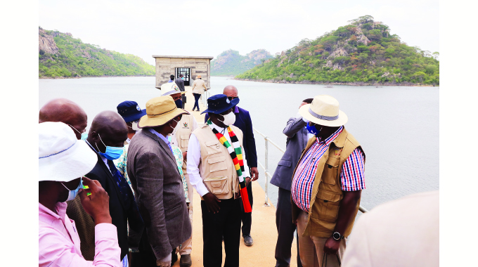
Owner: Government of Zimbabwe
Location: Buhera District, Manicaland Province. It is on Mwerahari River which has an annual flow of 182 million cubic metres
Year project was first proposed: 1971
Year contract was signed: May 2003
Year construction started: May 2003
Year construction stopped: It first stopped in May 2008 and stopped for the second time in June 2014 due to funding challenges
Year project was reviewed: August 2017 and Second Republic fast-tracked the construction
Project cost: US$33 million which was internally generated
Contractor: China Jiangxi Corporation
Implementing Agency: Zimbabwe National Water Authority (Zinwa)
Dam type: Zone Earthfill
Gross capacity of lake: 50 million cubic metres
Surface area: 546 hectares
Maximum dam height: 35 metres
Maximum water depth: 28,2 metres
Dam wall crest length: 470 metres
Spillway length: 120 metres
Construction status: Dam construction is complete and was commissioned by President Mnangagwa on November 11, 2020
Catchment: Save River
Benefits
λ Murambinda water supply. The dam is located 7km west from Murambinda Growth Point
λ Agriculture – Murambinda is in Ecological Region 5, and 85 percent of crops this season were written off due to prolonged drought
λ Dam will support irrigation on 1 250 hectares and boost peoples’ incomes.
λ Under first phase, two irrigation schemes – Guwanda 100 hectares and Kwarire 400 hectares – are being prioritised this year
λ Fisheries will generate incomes too and improve nutrition
λ Tourism – boat cruising, keeping wildlife are planned
λ Power generation
λ Dorowa mine will get water from Marovanyati Dam
λ Employment creation on irrigated farms, tourism sector, etc. — Compiled by Africa Moyo


 Online Reporter