Online Reporter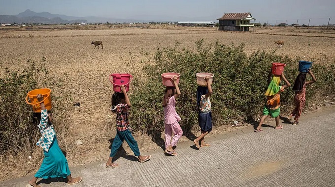
BBC – The El Niño event that is developing over the Pacific Ocean is likely to be the strongest in living memory, the Met Office has warned.
The powerful natural climate phenomenon pushes up global temperatures and can increase the risks of extreme weather.
Added to the effects of human-induced climate change, the Met Office is warning that it is “very likely” to mean 2027 is the hottest year on record globally.
There is growing evidence that weather patterns around the world are already being affected, with below-average monsoon rains in India and suppressed hurricane activity in the Atlantic Ocean.
El Niño could put the UK at greater risk of a wet, stormy autumn with signs of a very unsettled spell already showing up in long-range forecasts.
“We should be clear that this is an unprecedented event,” said Prof Adam Scaife, head of long-range forecasting at the UK Met Office.
“I have never seen an El Niño signal this intense in our forecasts.”
There is no clear evidence that climate change is making El Niño events more likely, but its weather impacts are likely to be more extreme in a warming world.
What is El Niño?
El Niño is a naturally occurring weather pattern, which happens about every two to seven years, lasting for around a year.
Trade winds that typically blow from east to west across the Pacific Ocean can weaken or even reverse, allowing warm water to spread eastwards.
Heat is released from the ocean into the atmosphere, lifting global temperatures and shifting rainfall patterns.
Scientists typically declare an El Niño when sea surface temperatures in a key area of the Pacific are 0.5C or more above the long-term average.
Current measurements show that they are well over 2C above normal.
Latest forecasts from the Met Office suggest that this warming could exceed 3C later this year as El Niño nears its peak.
This would be unprecedented in records going back to 1950, and probably the strongest event since the 19th century, the Met Office says.
Very high temperatures in the deeper ocean – around 8C above normal at a depth of 100m (330ft) in some places – could help to supercharge this El Niño, essentially providing a reservoir of warm water fuel to reinforce the event.
“We have many months to go while this event continues to develop and that’s one of the reasons that we have increased confidence that this will be a record-setting event,” said Dr Zeke Hausfather, a climate scientist at Berkeley Earth, a US research group.
Some other climate groups have projected something even stronger than the Met Office’s forecast, perhaps even 4C above average.
If that came to pass, “it’s not beyond the realm of possibility to say this might be the strongest El Niño event in 500 or even 1,000 years,” Hausfather said.
Is climate change making El Niño worse?
The World Meteorological Organisation (WMO) says there is “no evidence” that climate change increases the frequency or strength of El Niño events.
However, this is an ongoing area of research and debate for scientists.
A 2021 report from the Intergovernmental Panel on Climate Change (IPCC) – an international group of scientists – said that the intensity of El Niño appears to have increased since 1950, when compared with the period dating back to around 1400.
However, historical records show that El Niño has fluctuated significantly in its strength over past millennia so it is difficult to link this recent strengthening to global warming.
What is clear is that El Niño is now happening against the background of a warmer world – making its impacts on the weather more extreme.
Weather impacts around the globe
The change in the distribution of heat across the ocean – and shifts in the wind patterns in the atmosphere above – can have wide-ranging effects on the weather right across the globe.
No two El Niño events are the same and the impacts on weather patterns can vary – but there is evidence they are already being felt.
For example, in years with an El Niño event the southwest monsoon can deliver suppressed rainfall in South Asia – and so far in 2026 it is running well below normal.
In areas close to the tropical Pacific, the influence of El Niño can be profound, with a greater risk of drought and wildfires in northern parts of South America and Australia.
It can also increase the chance of flooding in other countries, such as Peru, Ecuador and the southern United States.
In past events, the disruptions to weather have hit crop yields – such as coffee, rice and cocoa – in many parts of the world.
This has been linked to spikes in food prices and hundreds of billions of dollars in lost GDP globally, as crop failures and trade disruptions ripple through supply chains and economies.
Earlier this month, the UN’s Food and Agriculture Organization warned that this El Niño could threaten tens of millions of people in at-risk countries with crisis-level acute food insecurity.
While El Niño fuels weather extremes in many parts of the world, in others it can have the opposite effect.
Changes in wind patterns in the Caribbean and tropical Atlantic can reduce hurricane activity. So far this season there have been only three named storms.
The effects of El Niño on the UK’s weather are much more muted than in tropical regions. It is not thought to have had any significant effect on the record-breaking heatwaves that have dominated this summer.
However it could have a greater impact on the weather during autumn and early winter, with the increased potential for wet and stormy conditions across north-west Europe, including the UK.
Perhaps counter-intuitively, El Niño can also increase the odds of cold weather late in the winter, although the links are rather loose.
2027 ‘very likely’ to be the hottest on record
Global average temperatures have already risen by roughly 1.4C since the late 19th century as a result of human activities, such as the burning of fossil fuels.
And during El Niño events, significant heat is released from the ocean to the atmosphere, giving temperatures a temporary boost.
Met Office climate scientist Dr Nick Dunstone said this effect is particularly pronounced in the calendar year following the winter peak of the El Niño.
“Hence, 2027 is very likely to replace 2024 as the warmest year on record,” he said. – BBC