Liberty Dube
Tourism Correspondent
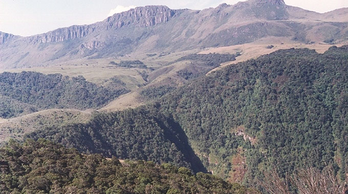
AN arduous, yet exhilarating journey to the rugged and towering Chimanimani Mountains is a treasured experience.
The mountains which straddle the Mozambique-Zimbabwe border provides a great exploration experience, especially for hiking enthusiasts.
It is a fulfilling and satisfying adrenalin-filled experience to have a date with the mountain that houses diverse forests with both indigenous and exotic trees.
The mountains are in the southern area of another tourism majestic area — the Eastern Highlands — which is a belt of highlands that run along the border between the Zambezi and Save Rivers.
The mountains include Monte Binga (2 436m), which is the second highest in Zimbabwe but the highest in Mozambique.
The better part of the mountain range is composed of quartzite ridges running north and south, with Monte Binga as the highest point.
Other peaks include Mt Peza (2 152 m), Mt Dombe (2 188 m), and Mawenje or Turret Towers (2 362 m), which are all in Zimbabwe; as well as Mt Nhamadimo (2 144 m) in Mozambique.
The mountains are drained by tributaries that go into Buzi River. Rusitu, referred to as Lucite in Mozambique; the Mussapaare of Chimanimani and Sussundenga of Mozambique’s Manica Province are among the tributaries.
Chimanimani receives rainfall throughout the year, with the average temperature being 16 °C. It is advised that a visitor should embark on the journey to the tourism site during summer time.
Several accommodation facilities and camping sites are available, although camping sites on the foot of the mountain may be a bit dangerous.
The mountains are home to three types of miombo woodland.
Trees are generally four to eight metres high, with some canopy cover, with grass covering the ground.
These are Mzhenje, Msasa and Woodland of Brachystegiatamarindoides.
Mzhenje woodland is found on east-facing slopes below 1 200 metres elevation, typically on schist-derived soils.
Mzhenge is accompanied by other trees at lower elevations.
Msasa woodland is also found on schist soils.
Trees tend to grow low (two to four metres high) and are widely scattered at higher elevations.
At lower elevations, the trees grow higher and closer.
Woodland of Brachystegiatamarindoides grows on quartzite outcrops and rocky slopes.
The trees grow low and spreading, and are draped with tassels of Usnea lichen.
Trees form a closed canopy, while the understory plants are mostly ferns and mosses.
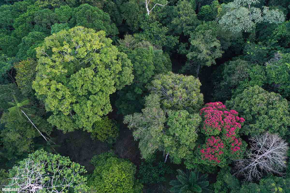
The transitional forests include the large shrubs and small trees.
Groves of the large banana-like shrub Strelitziacaudata and the tree fern Cyatheacapensis grow in sheltered stream-side locales surrounded by more open vegetation.
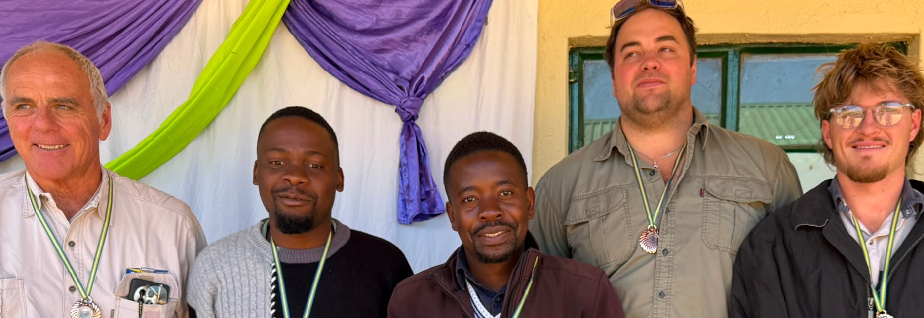
Government and other stakeholders have been hailed for making significant strides to improve and resuscitate key infrastructure like roads, mobile phones network connectivity and power to Chimanimani, which can spur the tourism industry.
It is also imperative to point out that there are new tourism opportunities which were presented by Cyclone Idai as several waterfalls emerged.
Exploring the Chimanimani mountains should definitely be on the bucket list of any visitor.
“Chimanimani is a must go place. The curves, weather and exotic trees are soothing and a marvel to a visitor. It is refreshing and has several options for activities, including hiking, fishing and bird watching, among other things,” said tourism and hospitality analyst, Mr Willard Madhombiro.
“It is a route full of adventures. A drive along the curves, strolling onto some parts of the mountain is a heaven-full adventure. We strongly encourage tourism players to use expos like the ZITF, and the Sanganai/Hlanganani World Travel Expo to launch tourism products and services in Chimanimani.
“Chimanimani was devastated by the March 2019 Cyclone Idai, but it is now back on its feet, thanks to the various stakeholders, tourism players and many others who played a critical role to ensure that the tourism sites were rehabilitated,” said Mr Madhombiro.
Chimanimani National Park was established in 1949 with an original area of 82km2.
The park was later expanded to 155km2 in 1953, with Mozambique gazetting the forest reserves of Maronga, Zomba and Moribane on the mountains’ south-eastern slope.
Extensive plantations of pine, wattle and eucalyptus were established in the mountains and valleys west of the National Park.
During the liberation war, mountain passages in Chimanimani were frequently used by liberation fighters moving between Zimbabwe and Mozambique.