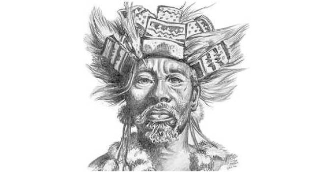
Pathisa Nyathi
The move to Mhlahlandlela as the last seat of power for the old King Mzilikazi KaMatshobana was significant in more ways than one.
For the first time the king located his capital town in the geographical section of the state which had been occupied by the Khondwane Ndiweni-led villages/ regiments. Mhlahlandlela was to be his last capital as he would pass on in September 1868 after residence at Mhlahlandlela lasting a mere five years.
At that time whites were taking a keen interest in Matabeleland. Gold had been discovered in the Tate area in 1867 and John Swinburne and group approached the king to seek permission to exploit the gold reefs. Hunters were beginning to come in larger numbers, a trend that accelerated during King Lobengula’s tenure.
For the purposes of this article our interest lies in the identification of villages that constituted isiphika, the defensive line of villages that fringed the capital town Mhlahlandlela as the name of the capital town existed before 1863.
Mhlahlandlela was located close to the Apies River in present day Pretoria where the king and his followers were domiciled from 1827 to 1832.
This time the naming of the last capital town was a matter of memorialisation of a historical name. Historical names back in KwaZulu-Natal were used again in Matabeleland. Examples include Entumbane, Ingome, Umzinyathi, KoBulawayo, inter alia.
Back in 1827 the king and his people were indeed pathfinders, or trailblazers. Before settling at Mhlahlandlela the king had been domiciled at Ezinyosini near the Vaal River (uLikhwa) from 1822 to 1827. Mhlahlandlela in Matabeleland was located south of present day Bulawayo, along the present Old Gwanda Road.
It is the road leading to BICC’s Matopo Mission.
The nearest source of water was Umhlonyane River, actually a stream which is a tributary of Umzingwane River. A few kilometres from Mhlahlandlela, the drainage system is part of the Zambezi catchment. Khami flows westwards and eventually pours its waters into the Gwayi River catchment.
The area enclosing isigodlo is on highest ground. The king occupied the highest place. A contour map would indicate that. Old Bulawayo was arranged in the same way to reveal the king’s highest status within a settlement.
The king was highest on the political and socio-economic ladder and also in terms of physical terrain: inkosi phezulu! Here the old king lived with some of the younger queens. His sons that were associated with Mhlahlandlela were Mahlahleni (Reverend Manhlenhle’s father), Makhulambila (buried at Empandeni Mission) and the last born son, Nyanda.
It is worth noting that the choice of settlement was determined by, among other considerations, availability of water for both humans and livestock. A look at the distribution of Ndebele settlements will reveal that all settlements were located near perennial streams of water.
Today the streams may no longer be perennial.
At the headwaters of Umzingwane River was the village known as Umzinyathi which originally was under the leadership of the Gwebus. Majijili was its first chief. When Majijili was old the Khumalos (Mkhaliphi kaDlekezela) took over.
For a long time the Khumalos held on to the chieftainship until in more recent times when Mthonzima Gwebu wrestled the chieftainship. The names of chiefs at Mzinyathini tell stories of contested claims to the chieftainship-Mangamani, Mthonzima.
Umzinyathi was a name that existed back in KwaZulu-Natal and may have been given in recognition of the fact that buffaloes teemed in the area.
Further down the same Umzingwane River was Amatshetshe, a village which, like Umzinyathi, had been led into Matabeleland by Khondwane Ndiweni. Amatshetshe seem to have been established at the time the Ndebele were resident in the Limpopo Province. The name seems to insinuate energetic campaigning movements of military personnel.
The regiment extolled itself as “abathwali bophahla”, the carriers of a roof. The roof being referred to here is not of a hut but of an ox-wagon. In those days ox-wagons were tented to keep out rain and solar heat.
After capturing an ox-wagon from the Griquas, Amatshetshe wished to let the king know about their valour. They lifted the tent and presented it to the King to see that indeed they had beaten off the Griquas ad captured their ox-wagon.
From then on, they earned the regimental praise of “abathwali bophahla”. Another of their famed praises is “abangen’ indl’ ivaliwe” — they enter a closed hut. Their chief was Sifo Masuku (who married King Mzilikazi’s eldest daughter Batayi), the most senior house among several Masuku chiefly families: Mkhanyeli Masuku(at Engwegweni), Mkhokhi kaLanga Masuku(at Nyamayendlovu and Mbiko kaMadlenya (at Zwangendaba/ Engcekezeni).
Both Umzinyathi and Amatshetshe were to the south of Mhlahlandlela, being part of Amnyama angankomo section alongside Amakhanda led by the Dlodlos.
Intekelo was further to the east under the leadership of Magazi Tshili. Not very far to the north was Intshamathe under Sungulwana Xaba. To the west there was Izinala/ Izisongo under Thunzi Ndiweni, son of Mabuyana, son of Khondwane Ndiweni, who was killed on the orders of King Lobengula for allegedly supporting Prince Nkulumane against Lobengula.
Thereafter Faku, a younger brother of Thunzi took over and consolidated his position by marrying King Mzilikazi’s daughter, one Princess Nedlana.
To the west there was Inyanda, a name referring to a collection of spears, inyanda yemikhonto. Mazwi Khumalo (of Inzonda section) was in charge. Its position is today marked by the name of a farm, Mahiye and the proliferating acacia trees all around.
For quite a while after occupation the people lived on the land that was part of the Rhodes Estate. It was a place Rhodes provided to lure the Ndebele out of the Matobo Hills where he could control them.
Once evicted, some of the people went to live on Nkonyane Farm at the confluence of Malunde and Wovi Rivers.
Apparently, Masvingo was after independence briefly named Nyanda. The name was quickly changed to Masvingo. The name carried a lot of meaning. In 1890 the so-called Pioneer Column entered Mashonaland.
King Lobengula took various measures to deal with the situation. Amatshetshe under Manyakavula Masuku, Chief Sifo’s son, were relocated to West Nicholson to keep guard over that part. Insukamini was moved to near Gweru.
Arms, in the main spears, were cached in the vicinity of a hill to the south of Masvingo town. Inyanda referred to the hill where Ndebele arms were cached. Dr Eddison Zvobgo was instrumental in the change of the name from Nyanda to Masvingo.
On the 5th of September 1868 the mountain fell at Enqameni and the corpse was brought to Mhlahlandlela where it was kept and guarded over till November when interment took place in a cave on Entumbane Hill.
It was the end of an era, but the idea of shielding a capital town through strategically positioning of settlements around it endured.