Gibson Mhaka, Senior Features Writer
FORESTS are more than vast stretches of trees covering the landscape. They are living ecosystems that provide clean air and water, shelter wildlife, support livelihoods and play a critical role in regulating the climate.
Yet managing and protecting these ecosystems in the face of deforestation, veld fires, pests, diseases and the growing effects of climate change is no small task.
For decades, forest management has largely depended on people physically entering forests to measure trees, assess vegetation, identify threats and collect data.
While these traditional methods remain important, they can be labour-intensive, time-consuming and difficult to implement across vast and often inaccessible areas.
Now, technology is beginning to change the way forests are monitored and managed.
In Zimbabwe, the Forestry Commission is embracing drone technology to strengthen forest monitoring, improve the accuracy of data collection and enhance the country’s ability to assess its forest resources.
The initiative is being implemented under a technical co-operation project between the Ministry of Environment, Climate and Wildlife and the Food and Agriculture Organisation of the United Nations (FAO), with a recent unmanned aerial vehicle (UAV) LiDAR data collection mission conducted in Lupane and Gwayi Forest.
The project, titled “Strengthening capacities of national institutions for improved forest monitoring systems in Botswana, Malawi and Zimbabwe”, seeks to enhance the capacity of national institutions to generate reliable forest data for climate change reporting and sustainable forest management.
The deployment of UAV LiDAR technology is expected to provide the Forestry Commission with highly detailed information on forest structure, biomass and carbon stocks, potentially addressing some of the limitations associated with conventional forest monitoring methods.
Zimbabwe continues to strengthen its National Forest Monitoring System in line with its obligations under the FAO Forest Resources Assessment, the United Nations Framework Convention on Climate Change and the Paris Agreement.
The country has already developed and submitted its first Forest Reference Emission Level (FREL) and is preparing subsequent submissions as it seeks to access results-based payments under the Reducing Emissions from Deforestation and Forest Degradation (REDD+) programme.
However, accurately determining the amount of carbon stored in forests remains a major scientific challenge.
Previous national assessments have largely relied on field measurements and satellite-derived land-cover data which, while useful, have limitations when it comes to capturing detailed forest structure and estimating above-ground biomass.
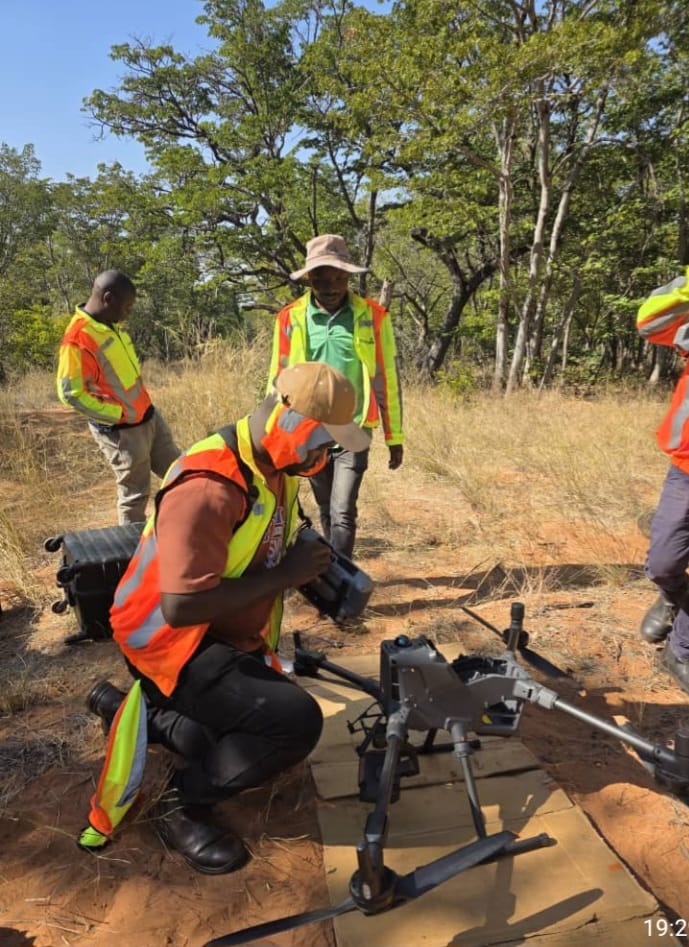
The latest intervention seeks to bridge that gap by combining information collected on the ground with highly detailed data captured from the air.
UAV LiDAR, or Light Detection and Ranging, uses laser pulses to measure the distance between the sensor and objects on the ground, generating high-density three-dimensional point clouds that can provide detailed information on vegetation structure.
For Zimbabwe, the technology could significantly improve the country’s ability to estimate biomass and carbon stocks, particularly in dry forest ecosystems where vegetation structures can vary considerably.
The exercise builds on data gathered during the development of the country’s first FREL, when a network of permanent sample plots was established in key forest ecosystems, including Kazuma, Panda Masau, Kavira and Sijarira forests.
These permanent plots provide an important long-term database for monitoring changes in forest ecosystems and carbon stocks.
However, the biomass estimation models currently being used were developed from relatively limited datasets and may not adequately capture the structural variability of Zimbabwe’s dry forests, including Baikiaea plurijuga woodland systems.
This creates a need for more advanced technologies to validate and improve existing models.
The UAV LiDAR mission is therefore intended to integrate aerial data with information from established permanent forest plots, creating an opportunity to validate existing allometric biomass models while developing new LiDAR-derived models capable of improving biomass estimation across Zimbabwe’s forest ecosystems.
The exercise is also expected to contribute to a stronger Measurement, Reporting and Verification system, which is critical for demonstrating the country’s progress in reducing emissions from deforestation and forest degradation.
The mission involved flight planning and calibration, LiDAR scanning over permanent sample plots and the collection of high-density point-cloud data. Field verification was also undertaken, including the re-measurement of selected plots, collection of ground control points and verification of tree species.
The combination of these different sources of information is important because drone technology does not replace field-based forestry research but complements it.
Data collected from the air must be matched with accurate measurements from the ground to develop reliable models that can subsequently be applied over larger areas.
This is particularly important in forests such as Gwayi, where accurate information on forest structure, biomass and carbon stocks can help strengthen management decisions.
The technology also has the potential to reduce some of the challenges associated with conventional forest assessments, which can be labour-intensive, time-consuming and difficult to scale up across extensive forest areas.
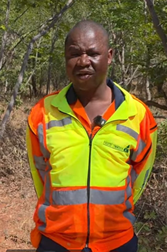
Mapping and Inventory Officer and Chief Drone Pilot with the Forestry Commission of Zimbabwe, Mr Anderson Muchaona said Gwayi Forest, one of the country’s largest gazetted forests, covers about 148 000 hectares.
He said monitoring such a vast forest using conventional methods could take months.
“Gwayi Forest is one of the biggest gazetted forests in Zimbabwe, measuring about 148 000 hectares.
“We have been monitoring this forest for quite some time using traditional methods, where we would go into the field and measure the trees. This would take months to complete,” said Mr Muchaona.
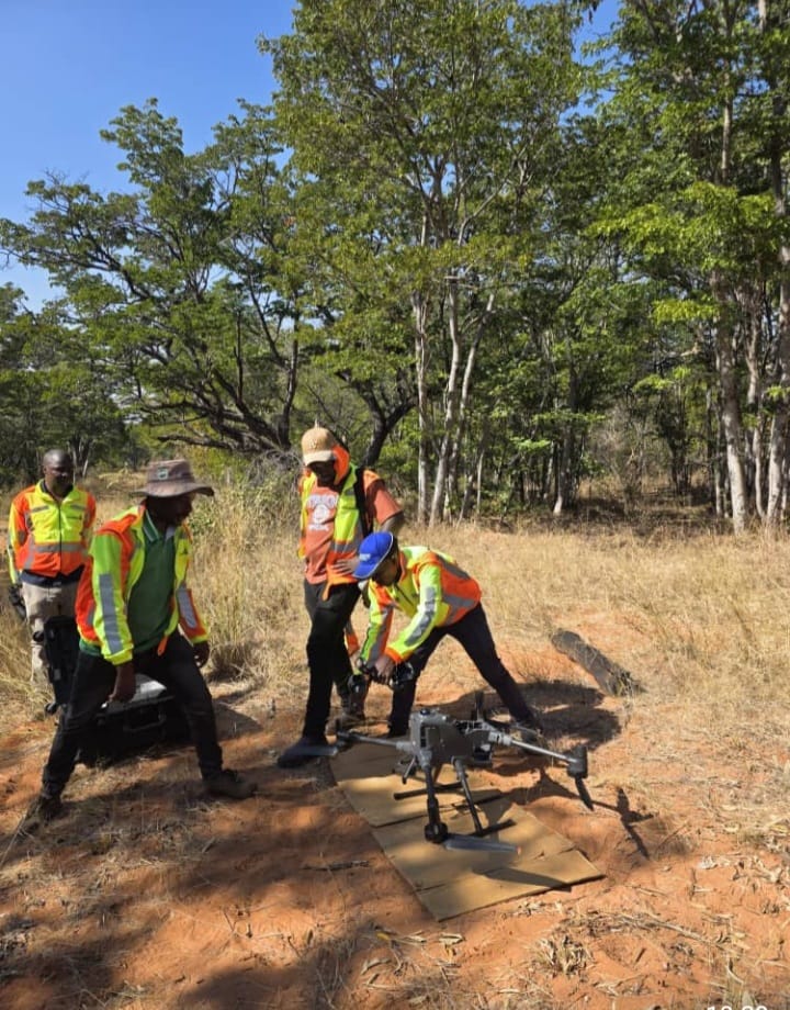
The introduction of LiDAR-equipped drones, he said, was providing the Commission with an opportunity to transform that process.
“But with the coming of drone technology, we decided to procure a LiDAR-equipped drone. A LiDAR-equipped drone is capable of taking direct measurements on the ground, replacing the traditional methods where we would physically go into the field to measure the trees before returning to the office to capture and analyse the data,” he said.
The objective, Mr Muchaona said, was not simply to introduce sophisticated equipment, but to improve the quality and coverage of forestry information.
“With the use of drones, our aim is to increase coverage, improve efficiency and improve the quality of the data we collect,” he said.
The Forestry Commission is currently conducting a pilot project to establish how accurately drone technology can replicate and improve upon measurements obtained through conventional field methods.
“At this stage, we are conducting a pilot project where we need to validate what is on the ground using traditional methods against what is captured using drone technology.
“Once we complete the validation process, we will upscale the programme,” said Mr Muchaona.
For Zimbabwe, the exercise is also an opportunity to generate local knowledge about the application of drone technology in dry forests.
Mr Muchaona said drones had traditionally been used extensively in places such as Brazil and the Amazon, but their application in dry forest environments was comparatively less common.
“We are therefore conducting this pilot project to establish how the technology can be effectively applied in our dry forest environment. The lessons we learn here will inform how we move forward,” he said.
Beyond simply taking aerial photographs, the technology can generate detailed information about the condition and structure of forests.
By analysing canopy height and vegetation density, forestry officials can calculate tree volume and estimate biomass, while mapping carbon stored within forest ecosystems.
“By analysing canopy height and vegetation density, we are also able to calculate tree volume and map carbon storage across the forest.
“What used to take much longer can now be done faster, smarter and with greater accuracy,” said Mr Muchaona.
The significance of this technology extends beyond forestry inventories to broader environmental monitoring and conservation.
National Tree Ambassador and director of Isandla Esihle/Ruoko Rwakanaka, Mr Never Bonde, said drones had emerged as powerful tools in modern forestry because they could capture detailed information from areas that were difficult for people to access.
“Drones, or Unmanned Aerial Vehicles (UAVs), have emerged as powerful tools in forestry.
“Equipped with high-resolution cameras and sensors, drones can capture detailed images and data from above, providing insights that were previously difficult to obtain,” he said.
Mr Bonde said the broader integration of technology was also helping address some of the challenges posed by climate change while supporting reforestation, afforestation, wildlife conservation and biodiversity protection.
“Technology aids in addressing the challenges posed by climate change, enhancing efforts in reforestation and afforestation, and supporting wildlife and biodiversity conservation through tools like camera traps and satellite tracking,” he said.
He said technology was also opening new avenues for communities to participate in forest stewardship through digital platforms that can facilitate education and public participation.
“The integration of technology into modern forest management has revolutionised the way we monitor, conserve and utilise forest resources,” said Mr Bonde.
“Historically, forest management relied heavily on manual techniques and rudimentary tools, which often limited the scope and accuracy of data collection and analysis.
“Today, advancements in remote sensing, Geographic Information Systems, drones and precision forestry have given forest managers unprecedented capabilities to map and monitor vast forested areas with high precision.”
The benefits of drones extend beyond forestry inventories to broader environmental monitoring and conservation, where the technology is increasingly being used to provide detailed information on ecosystems that would otherwise be difficult and costly to obtain.
Environmentalist Mr Liberty Dube said drones were increasingly becoming important in environmental monitoring and conservation because of their ability to collect high-resolution aerial data efficiently.
“Drones play a crucial role in environmental monitoring and conservation.
“They enable the collection of high-resolution aerial imagery and data, facilitating the assessment of ecosystems, wildlife populations and habitat conditions,” said Mr Dube.
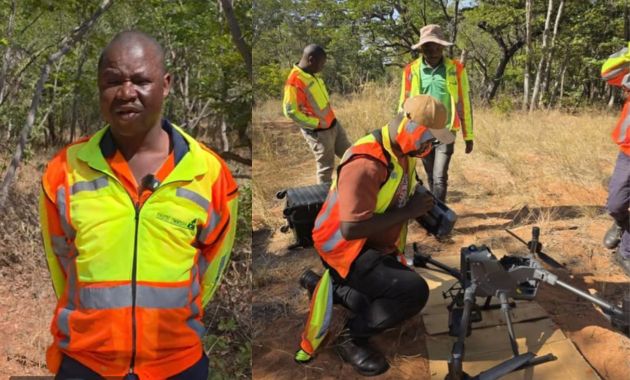
He said the technology could be deployed in a range of environmental applications, including habitat mapping, wildlife tracking, and pollution assessment and monitoring vegetation health.
“Drones can capture detailed aerial photographs to assess vegetation health and biodiversity, which is crucial for conservation efforts,” he said.
Mr Dube said drones were also proving useful in tracking environmental changes over time, particularly in monitoring deforestation and changes in land use.
“Drones play a crucial role in assessing environmental changes. They can monitor deforestation and land-use changes by capturing high-resolution aerial imagery and utilising remote-sensing technology,” he said.
The technology is therefore giving environmentalists and forestry managers a bird’s-eye view of changes that may be difficult to detect from the ground, allowing them to identify threats earlier and respond before damage becomes more difficult to reverse.
However, the transition towards technology-driven forestry management is not without challenges.
The cost of acquiring sophisticated drones and sensors can be high, while skilled personnel are required to operate the equipment, process the information and interpret the resulting data.
Regulatory requirements governing drone operations can also affect their deployment.
For Zimbabwe, the challenge will therefore be to ensure that the adoption of technology is sustainable and complements, rather than completely replaces, conventional forestry expertise.
Technology alone cannot transform forest management. Its real value lies in how the information generated is processed, validated, stored and ultimately used to inform policy and management decisions.
The success of the initiative will therefore depend on the Forestry Commission’s ability to institutionalise the use of UAV-derived data and build the technical capacity required to analyse and apply it.
If successfully integrated into the country’s forest monitoring systems, UAV LiDAR technology could help Zimbabwe build a more comprehensive picture of its forests, strengthen monitoring and enforcement, improve conservation planning and provide better information for climate-related initiatives.
Most importantly, the future of forest management may no longer be confined to what forestry officers can see while walking beneath the trees.
Increasingly, it will also depend on what they can see from above.
The drone hovering over a forest may look like a small machine against a vast canopy, but the information it captures could help answer some of the biggest questions facing Zimbabwe’s forests ,how much is being lost, how much remains, how healthy it is and how much carbon it stores.
For a country seeking to balance economic development with environmental sustainability, that information is becoming increasingly valuable.
The future of Zimbabwe’s forests, it seems, is being mapped not only on the ground, but also in the skies.