Gibson Mhaka [email protected]
YOUNG surveyors, geospatial professionals and researchers have been equipped with practical Geographic Artificial Intelligence (GeoAI) skills to strengthen Zimbabwe’s capacity to address climate change, environmental management and public health challenges through data-driven decision-making.
The training workshop, organised by Place Alert Labs and Midlands State University (MSU) in partnership with the Centre for Sexual Health, HIV and AIDS Research (CeSHHAR) Zimbabwe, was held recently during the Survey Institute of Zimbabwe Annual Conference and 58th Annual General Meeting in Bulawayo.
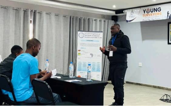
The practical session formed part of the 2026 Young Surveyors Pre-Conference and brought together 36 young geospatial professionals, students, researchers and practising surveyors who were introduced to cutting-edge Geographic Information Systems (GIS) workflows linking location data with climate, environmental and health information.
Participants undertook hands-on exercises using Zimbabwean spatial datasets, climate grids, satellite-derived environmental products, exposure timelines and Artificial Intelligence-assisted spatial querying tools to better understand the relationship between geography, climate and human health.
Facilitators said the workshop demonstrated how surveying and geospatial technologies can provide practical solutions to some of the country’s most pressing development challenges.
“Location is the bridge between seemingly separate issues,” the organisers said.
“Where people live, work and move shapes the climate, air quality, environment and services they are exposed to, and ultimately influences health and development outcomes.”
The organisers said surveyors and geospatial experts possess unique earth observation skills that place them at the centre of efforts to address climate-related challenges through evidence-based planning.
“Surveyors and geospatial experts are uniquely positioned, through their earth observation skills, to use geography as an organising principle, linking climate variables such as extreme heat with health data to support informed planning and decision-making,” the organisers said.
The workshop highlighted the growing importance of GeoAI technologies in urban planning, disaster risk management, environmental monitoring and public health, areas that are increasingly becoming critical as Zimbabwe confronts the effects of climate change.
Organisers said integrating artificial intelligence with geospatial science enables professionals to better understand environmental exposures and their impact on communities, thereby improving policy formulation and resource allocation.
The initiative also forms part of Place Alert Labs’ and CeSHHAR Zimbabwe’s broader commitment to translating research in spatial health, environmental exposure and artificial intelligence into practical training programmes for students, early-career professionals and practitioners.
“Our goal is to ensure that research does not remain confined to academic publications but is translated into practical skills that young professionals can apply in solving real-world challenges facing communities,” the organisers said.
They said plans were already underway to expand the programme through the development of additional open-access training modules covering drone-based data acquisition, air quality modelling and advanced environmental exposure assessment.
The organisers said equipping young professionals with emerging geospatial technologies would strengthen Zimbabwe’s capacity to respond to climate-related risks while contributing to sustainable development through evidence-based planning and innovation.