Online Reporter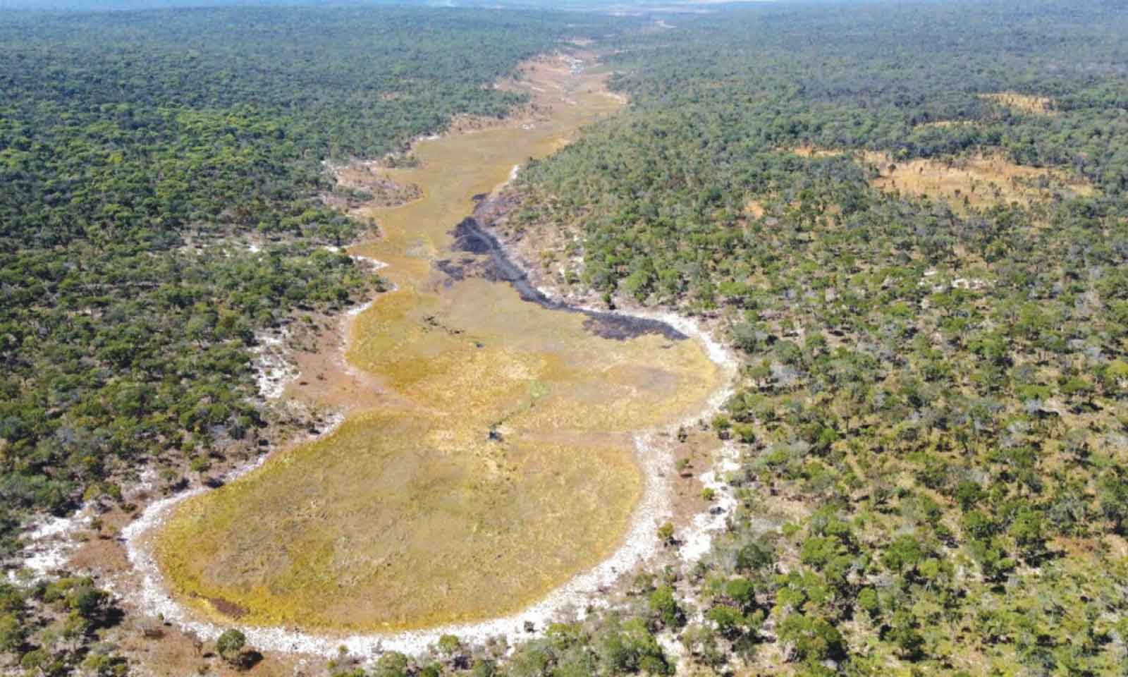
Sifelani Tsiko
Fact Check Editor
A comprehensive study, “The Wilderness Project on the Zambezi River,” the fourth-longest river in Africa and a lifeline for hundreds of millions across six southern African countries, reveals that the river’s source is a shallow depression in Angola’s southern highlands on the Lungwebungu River.
This is contrary to a long-held view that the river originates in the Kalene Hills of north-western Zambia, near the border with Angola, before it meanders across Zambia, Angola, Namibia, Botswana, Zimbabwe, and Mozambique, flowing eastward and eventually emptying into the Indian Ocean at a wide delta in Mozambique.
A river source, or headwaters, is the starting point of a river, usually in elevated areas like mountains or springs, where water from rain or groundwater first collects into a small channel that grows into a full river.
It’s often not one single spot, but a network of tiny streams within a watershed that feed the main river as it flows downhill towards its mouth, where it meets the sea.
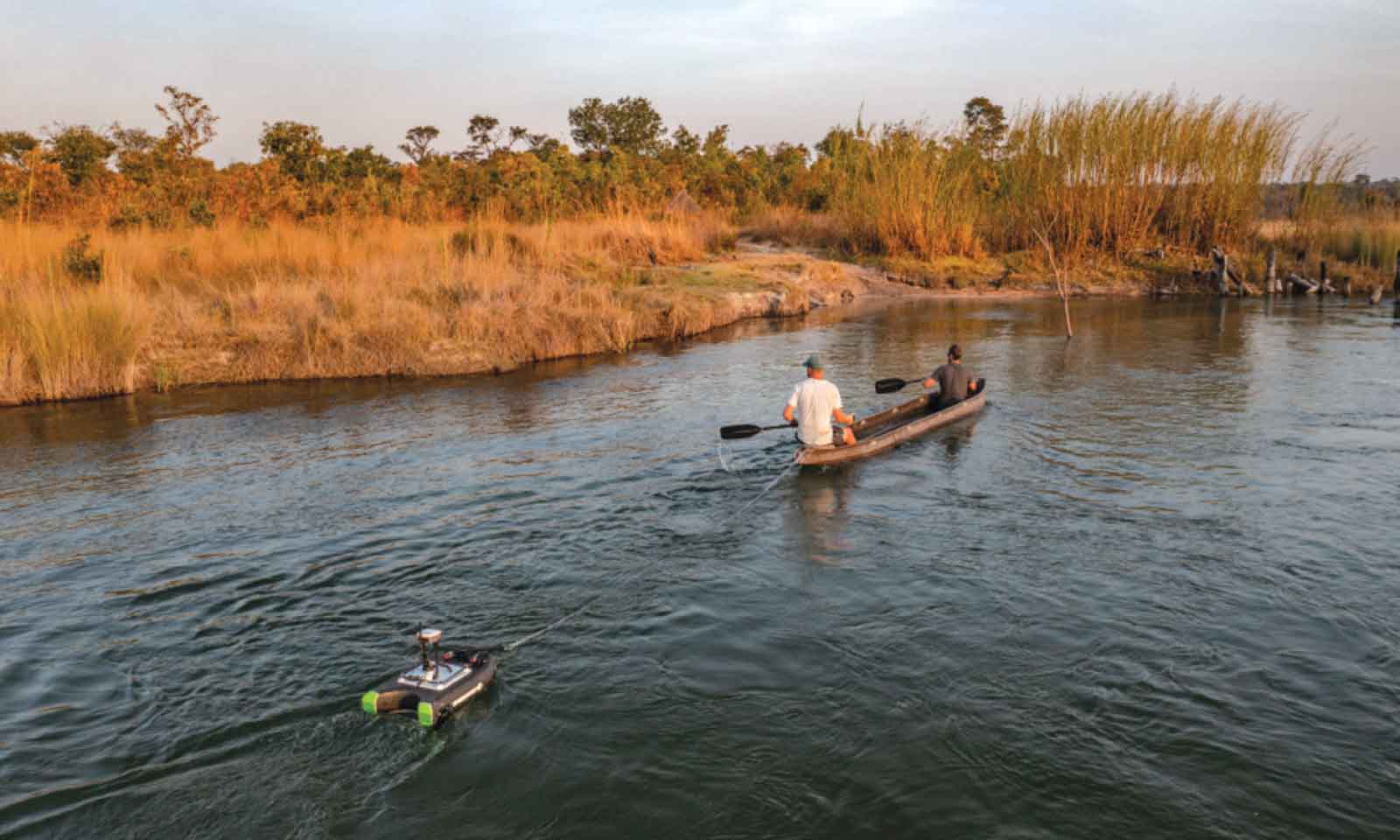
In a report that has been shared on various environmental platforms and in the media, a group of scientists and explorers under the Wilderness Project say the new water source in Eastern Angola gives the Zambezi a new total length of 3 421km, or 342km longer than previously thought. The researchers explored the river, revealing the real source and river flow patterns of the iconic river characterised by the majestic Victoria Falls, hydroelectric dams at Kariba and Cahora Bassa, and a diverse cultural and ecological landscape.
This study is of great importance and highlights the evolving role of upstream rivers in the flow dynamics of the Zambezi, which was previously thought to span approximately 2 574 kilometres.
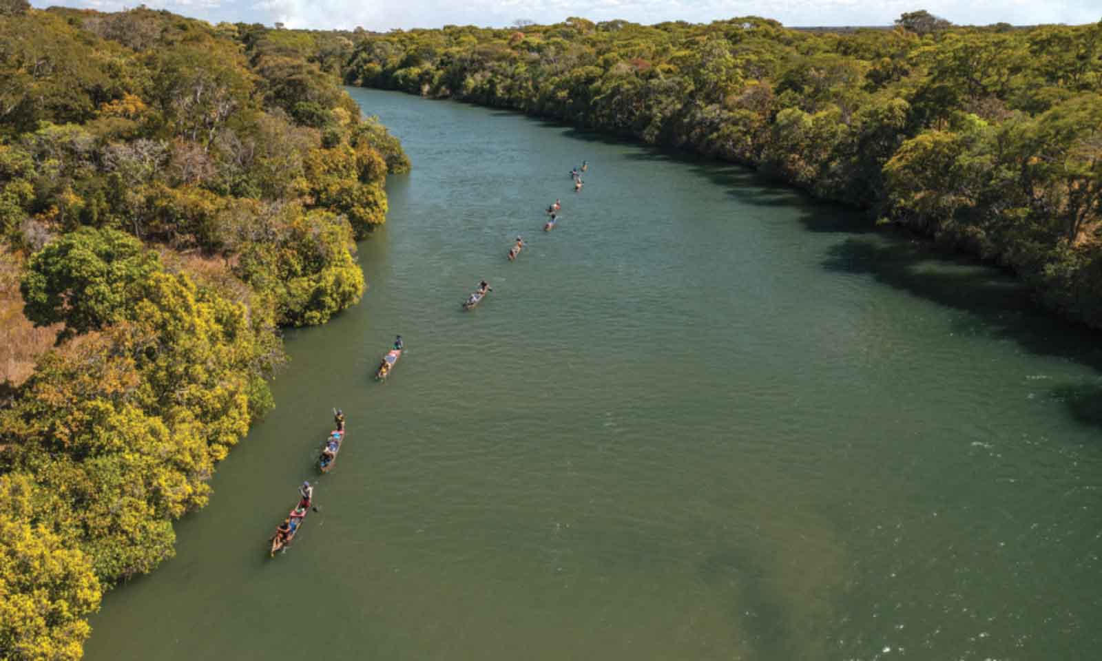
The river serves as a vital water source for six southern African countries and forms natural borders between several countries, such as the boundary between Zambia and Zimbabwe.
“The Lungwebungu and several other Angolan rivers contribute about 70 percent of the water reaching Victoria Falls, making them critical to the long-term health of the Zambezi and the people and wildlife who depend on it,” the researchers said in an online report.
“The study highlights the importance of protecting the Upper Zambezi Basin, where another recent study recorded significant forest loss over the past three decades.”
This new study underscores why greater emphasis for the long-term survival and sustainable development of the river must be placed on Angola, a key country for contributing to sustaining the Zambezi River, which is renowned for its breathtaking landscapes, including the famous Victoria Falls, one of the Seven Natural Wonders of the World.
“Having paddled [down the length of each river from] both sources – the Zambian one and the Angolan one – we figured out that 70 percent of the water that arrives in (Lake) Kariba (a giant hydropower reservoir on the Zambezi) or goes over Victoria Falls comes out of Angola,” lead author Rainer von Brandis of The Wilderness Project told Mongabay, a conservation and environmental news portal.
“That the Lungwebungu is further away from the end-point of the Zambezi than the traditional source in Zambia is just kind of an interesting fact; it makes the Zambezi longer, which gives more impetus to the river and gets all the downstream users to understand that this river essentially comes from even further (away), and the headwaters (in Angola) really are important.”
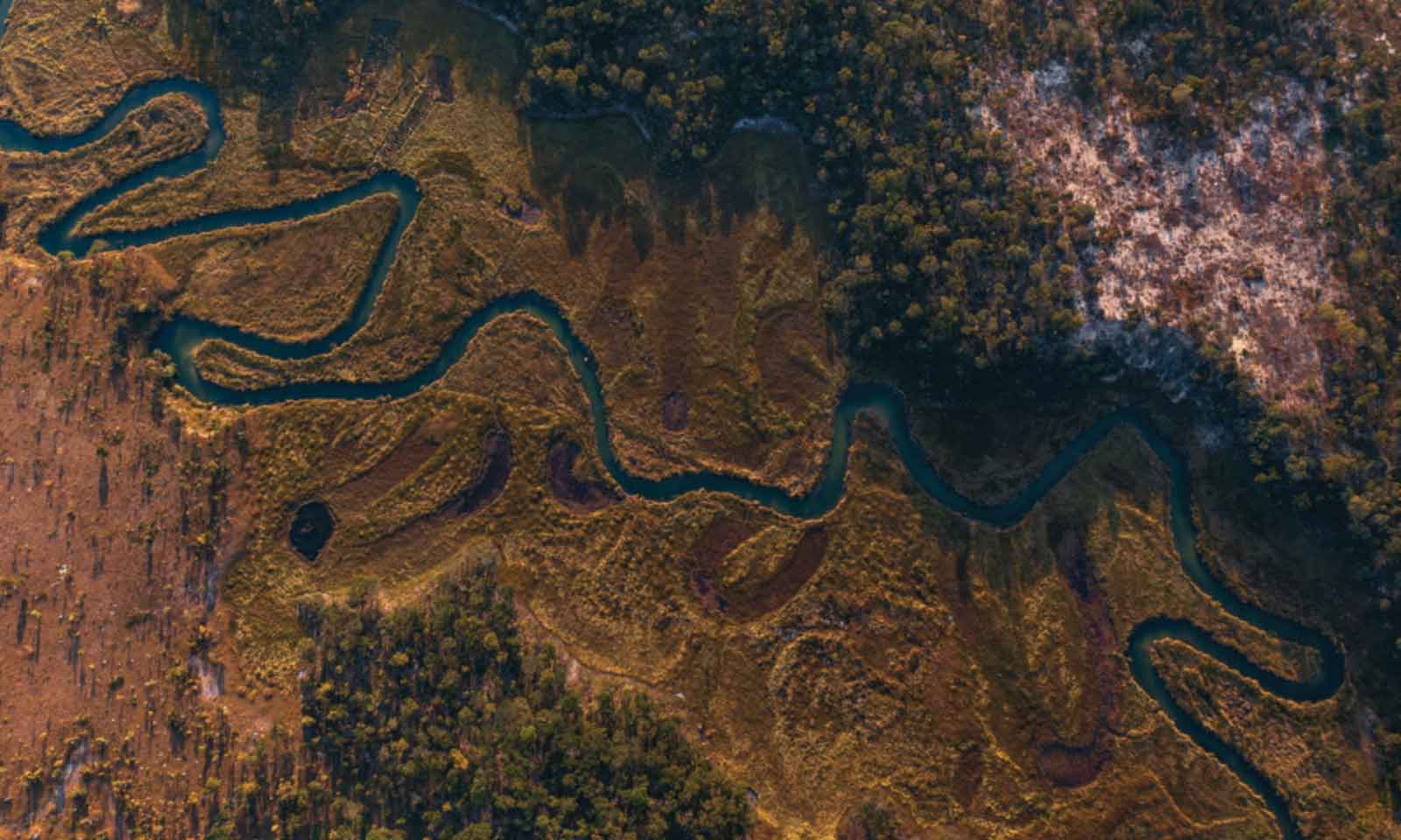
Researchers also state that three other major Angolan tributaries — the Chifumage, Luena, and Luanginga — also make significant contributions to the Zambezi river flow dynamics.
The major findings of the study showed that the rate of flow of water was just 16 cubic metres (565 cubic feet) per second close to a spring near Mwinilunga on the Zambian side, while on an Angolan section, the researchers discovered that when the river re-entered Zambia at Chavuma, the Zambezi flowed at a rate of 900m³/s, a more than 5 500 percent increase.
“That’s how much the river grows during the Angolan section of the Zambezi,” Von Brandis says.
All this, the researchers suggested, highlighted the critical importance of the Angolan highlands, also known as the Angolan water tower, to the survival of the Zambezi.
The researchers conducted two separate expeditions in 2022 and 2023, covering about 1 032 km of the Lungwebungu.
“It was a very remote piece of river, and very much intact ecologically,” Von Brandis was quoted as saying.
Environmentalists warn that human activities, if unchecked, can impact the magnitude and timing of the Zambezi river flow.
Pollution, unchecked human settlements, climate change, and other human-induced activities have all affected the Zambezi.
Over the past five or six years, the worst drought in a century reduced water flows to a trickle at Victoria Falls, where the Zambezi river cascades down 100 metres into a gash in the earth, attracting millions of holidaymakers to Zimbabwe and Zambia for the stunning views.
Climate change posed a major threat to the region’s biggest tourist attractions in 2019 and again around 2022 as southern Africa battled the catastrophic warming caused by human-driven greenhouse gas emissions churned out in industrialised countries in the north.
A prolonged drought in 2022 also led to the suspension of electricity generation by the Zambezi River Authority (ZRA) at Kariba hydropower stations run jointly by Zimbabwe and Zambia.
The two countries have suffered acute power shortages for several years, as successive droughts have resulted in poor inflows into the Kariba Dam.
“It means that countries need to work together more to avert the water stresses, which are induced because of drought,” says Frank Nyoni, a Zambian co-author of the study, former acting director in Zambia’s Water Resources Management Authority, and now regional manager with TWP.
Other water and environmental experts say this new study highlights the need for countries in the region to work closely to protect the Zambezi water catchment, which is increasingly coming under threat from deforestation and mining activities in both Angola and Zambia.
Another 2024 report indicated that nearly 4,4 million hectares (10,9 million acres) of forest — about 14 percent of the Upper Zambezi Basin — has been degraded over the last 30 years as land was converted for agricultural purposes.
Experts warn that unregulated settlements, deforestation, and mining activities may affect the Zambezi river flow dynamics, with profound impacts on the livelihoods of millions of people in the riparian states.