Ivan Zhakata
Herald Correspondent
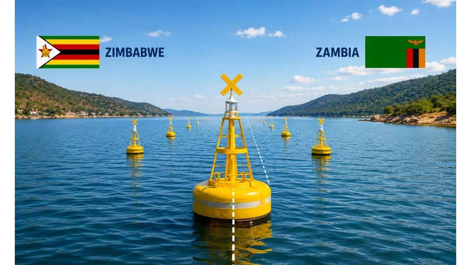
The installation of floating buoys on Lake Kariba to mark the existing international boundary between Zimbabwe and Zambia is expected to reduce cross-border disputes, improve safety and strengthen cooperation among communities that depend on the shared water body.
The development follows the successful completion of community sensitisation workshops held in Siavonga, Zambia, and Kariba on June 4 and 5 ahead of the commencement of the project.
The workshops brought together fishermen, boat operators, traditional leaders, local authorities and women traders from both sides of the lake and were organised by the Governments of Zimbabwe and Zambia through the Zambezi River Authority (ZRA), with support from the African union Border Programme (AUBP) and Germany’s Deutsche Gesellschaft fuer Internationale Zusammenarbeit (GIZ) GmbH.
Speaking during the workshops, Zimbabwe Surveyor-General Mr Edwin Guvaza said the project was not intended to create barriers between the two neighbouring countries.
“We want to assure you that as the two Surveyor Generals, we are not putting up barriers between the two countries on the lake as we establish these floating buoys. Rather, we are enhancing the visibility of the boundary to facilitate bilateral cooperation and peaceful co-existence between our two sister republics,” he said.
Zambia’s Assistant Surveyor-General, Mr Kelvin Chibangula, said the initiative was designed to address challenges arising from the invisible nature of the boundary on the lake.
“Unclear boundaries on the lake have led to challenges such as unintentional crossing, arrests in some cases, vessel seizures, and disputes,” he said.
“To address this, the two Governments, with support from AUBP and GIZ, agreed to pilot the installation of these floating beacons along the first 10 kilometres from the dam wall going upstream.
“These markers will make the boundary visible and allow fishing activities to continue without fear of conflict.”
The officials told participants that the floating buoys would only mark the existing international boundary and would not alter territorial rights, fishing grounds or access to resources on either side of the lake.
The stakeholders were also briefed on navigation procedures, emergency protocols for accidental crossings and community responsibilities in safeguarding the buoys and reporting incidents through designated focal points.
The workshops included interactive discussions on challenges faced by lake users and focused on establishing communication mechanisms and standard operating procedures for handling cross-border incidents.
The authorities said the project would be the first instance in the region where an agreed international lake boundary has been physically marked, setting a precedent for enhanced border governance and cooperation in the management of shared natural resources.