Judith Phiri, Business Reporter
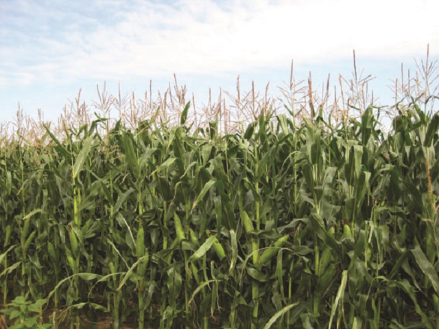
THE Zimbabwe National Geospatial and Space Agency (Zingsa) has established that over 1,7 million hectares were under maize in all the ten provinces during the 2022/2023 summer cropping season.
The agency which uses geospatial and satellite technologies to determine their estimates also revealed that Bulawayo province had the least number of hectarages with just 650 hectares under the maize crop. Using remote sensing and satellite imagery, Zingsa carried out the summer cropping yield estimation as a way of providing timely information for the optimum management of growing crops.
The statutory body works with the Ministry of Lands, Agriculture Fisheries, Water and Rural Development to determine the summer cropping yield estimation. Responding to the questions from Sunday News, Zingsa chief operations officer (COO) Mr Painous Gweme said the next phase of yield estimation is yet to be concluded.
“Geospatial and satellite technologies were employed in estimating the total hectares under maize in all the 10 provinces of Zimbabwe. It is estimated that a total of 1 754 014,74 is under maize nationwide. The province with the highest maize crop is Mashonaland West at approximately 448 553,97 hectares while Bulawayo province concludes the list with 650 hectares. The nation will be informed once the next phase of yield estimation has been concluded,” said Mr Gweme.
He said the good part regarding remote sensing and associated satellite images was that they provide repetitive coverage of the same area enabling them to determine the progression of the season and thus facilitate early detection of any anomalies during the season.
Mr Gweme said through processing satellite images they could determine crop conditions such as crop stress as a result of drought, nutrient deficiencies, monitoring of weeds, crop diseases, and even crop damage from floods or hailstorms.
“We have mapped the greater part of all water bodies in the country including river networks and dams. As previously mentioned, the monitoring of irrigation is mostly done in the dry season when rain-fed agriculture is impossible. As we develop the National Spatial Data Infrastructure (NSDI), we envisage mapping all irrigation schemes with the first phase focusing on government-supported irrigation schemes but with a long-term plan of mapping all irrigated areas in the country.”
In the same vein, Mr Gweme said they also intend to develop a mobile data collection system for recording water usage and evaporation from evaporation pans across the country. He said this called for the agency to collaborate with various stakeholders including the Zimbabwe National Water Authority (Zinwa) and the Ministry of Lands, Agriculture, Fisheries, Water and Rural Development (Irrigation Department).
Mr Gweme said the development of the NSDI was an ongoing process that seeks to create high-standard geospatial data for sharing, using, and integrating several datasets for the advancement of social, economic, and environmental aspirations of the country.
“So far, we have created the geodatabase that houses the datasets as well as the framework within which the spatial datasets can be accessed. Several datasets have been created and these include all rivers in the country, dams, clinics, schools, administrative boundaries, digital elevation models, among others. We envisage to create a common environment in which stakeholders and the public can access relevant data for decision-making,” he added.
Launched in 2018, the ZINGSA has the mandate to enhance the country’s capability to harness space technologies. It will also make it possible for the country to manage its natural resources and mitigate the effects of climate change.