
Desmond Manatsa, Correspondent
Following the successful hosting of the 44th SADC Summit, where Zimbabwe assumed the chairmanship, the nation’s attention now shifts to a critical sector that has long been the backbone of its economy: agriculture.
As the upcoming agricultural season approaches, the country must prioritise preparations to aim for a bountiful harvest. Central to this endeavour is utilising Zimbabwe’s Revised Agroecological Regions Map. This powerful tool, when effectively used, has the potential to significantly improve the national economy. In a country where agriculture is a way of life for nearly everyone, the benefits of this new map cannot be overstated.
However, it has remained underutilised despite its immense importance to the nation’s agricultural planning and management.
The Revised Agroecological Map provides maximum benefits when utilised with seasonal forecasting information in the planning process. As the 2024/25 seasonal forecasting meeting of SADC climate experts constituting the SARCOF (Southern African Regional Climate Outlook Forum) convenes in Harare, it is essential to consider the current climate influences affecting agricultural prospects in the region.
While we do not intend to pre-empt the outcomes of these climate expert discussions, it has become established within the climate scientific fraternity that the El Niño phenomenon, which had devastating effects on last season’s agricultural yield, is now behind us.
Many climate prediction models indicate a reasonable probability of the emergence of La Niña conditions. Historically, La Niña is associated with favourable weather patterns that can significantly enhance agricultural productivity in Zimbabwe, offering hope for the upcoming season. However, it is crucial to remain cautious, as such outcomes are not guaranteed every season.
As such, the conclusions of the upcoming seasonal forecasts will be pivotal for farmers and stakeholders in Zimbabwe. The importance of the agricultural community paying close attention to the results of the SARCOF (Southern African Regional Climate Outlook Forum) seasonal forecasts cannot be overstated. Our Meteorological Services Department’s forecasts will provide vital insights tailored to Zimbabwe’s specific climate conditions, which are prerequisites for effectively using the Revised Map of Agroecological Regions.
The urgency of this attention is crucial for making informed decisions and planning for the upcoming agricultural season. We cannot afford to overlook the insights these forecasts can provide.
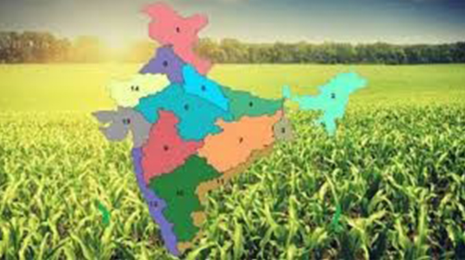
For those unfamiliar with the term agroecological regions, these are defined classifications that categorise land based on climate, soil characteristics, and potential for agricultural production. Zimbabwe’s diverse climatic zones, ranging from arid to semi-humid areas, inform specific agricultural practices suited to each region. As such, the agroecological region’s map provides insights into the suitability of various crops, the expected rainfall patterns, and the inherent soil fertility, aiding farmers in making informed choices about what to plant and when.
Consequently, the Revised Agroecological Regions Map of Zimbabwe is an updated version of the one developed in 1961 during the colonial era, which reflects the impacts of decades of changing climate across the country.
It is, therefore, crucial for Zimbabwe’s farm planning and management, as it provides essential insights into the significant changes in rainfall patterns, temperatures, and soil characteristics in recent decades. This information has profound implications for the suitability of different agricultural practices and crop varieties. It empowers farmers, policymakers, and researchers to make informed decisions about crop selection, land use, and water management.
Key findings from the revised map include the contraction of previously favourable regions (II, III, and IV) due to increased aridity and heat. In these regions, the delayed start, early termination, and shorter duration of the rainfall season, combined with fewer rainy days and longer dry spells, necessitate a shift towards more drought-tolerant and shorter-season crops.
Additionally, the observed increase in maximum temperatures exacerbates crop moisture stress, limiting certain varieties’ suitability. The implication is that certain crops traditionally grown in these regions may no longer be viable in some areas, and farmers may need to consider alternative crops more suited to the changing conditions.
Conversely, Region V, the least favourable region for rainfed agriculture, being characterised by low rainfall and high temperatures, is seen on the map to have expanded significantly at the expense of regions II, III and IV. The expansion was from about a quarter to almost a third (25.5% to 32.4%) of the country’s surface area. In the revised map, Region V was divided into two sub-regions to address the challenges posed by the increasingly dry conditions: Va and Vb. The southernmost parts of the country, now classified as Vb, are too dry for economically viable rainfed agriculture.
However, it was noted that Region I, the most agriculturally conducive region of the country, remained unchanged, indicating its relative resilience to climate change. This region, located in the north-eastern part of the country, continues to be well-suited for agricultural production due to its favourable rainfall patterns and soil conditions.
This means that farmers in this region may not need to make significant changes to their current agricultural practices and can continue to focus on farming practices that have traditionally been successful in this area.
The revised map avails essential insights into the development of climate-smart agricultural practices, such as agroforestry, intercropping, and cover crops, which can improve soil health, reduce water loss, and enhance biodiversity.
It guides livestock management, as certain breeds may be more suited to the changing climatic conditions. Furthermore, the map serves as a resource for developing targeted irrigation systems. By adopting these practices, farmers can increase their resilience to climate change and improve their agricultural productivity, helping to ensure a more reliable and sustainable food supply.
The map also informs land use planning and conservation efforts, prioritising the protection of natural ecosystems that play a crucial role in regulating water flows, carbon sequestration, and biodiversity conservation.
The revised agroecological regions map presents a new valuable tool for Zimbabwe’s agriculture sector. It is imperative that policymakers, farmers, and researchers heed the call to action and actively incorporate the insights provided by the revised agroecological regions map into their decision-making processes. By doing so, they can effectively address the challenges of climate change and work towards implementing climate-smart agricultural practices.
At the same time, public awareness of the revised agroecological regions map should not be the prerogative of agricultural extension workers but also the responsibility of government departments and institutions dealing with natural resources. By fostering a broader understanding of this crucial tool in government, we can ensure that its benefits reach a wider audience and contribute to the overall success of the agricultural sector.
Schools, universities and tertiary institutions should play their pay in this equation. Since these academic institutions actively implement the national education philosophy of Education 5.0, they are well-positioned to incorporate the revised agroecological map into their curricula. As such, they should be innovative enough to conduct studies on its applications and train the next generation of farmers, policymakers, and agricultural professionals. This comprehensive approach will help maximise the use of the revised map and drive sustainable farming practices across Zimbabwe.
The revised map provides essential information for farmers, policymakers, and agricultural researchers to make informed, updated decisions about land use, crop selection, and farming practices. By leveraging this new information, the country can develop more sustainable and resilient agricultural practices, improve food security, and create economic opportunities for rural communities.
This presents a promising future for Zimbabwe’s agriculture, but addressing the map’s underutilisation is crucial to ensuring its potential benefits are fully realised. Otherwise, by adopting the revised agroecological regions map more aggressively, Zimbabwe can better adapt to the challenges posed by climate change and ensure economic well-being, contributing to achieving the nation’s Vision 2030 goals.
– Prof Desmond Manatsa is a Climate Scientist and Head of the Climate Change Resilience Building Innovations Centre at Bindura University of Science Education. He led the national team of researchers that revised the Agroecological Regions Map of Zimbabwe and is actively advocating for its increased national uptake. dmanatsa@gmail.com.